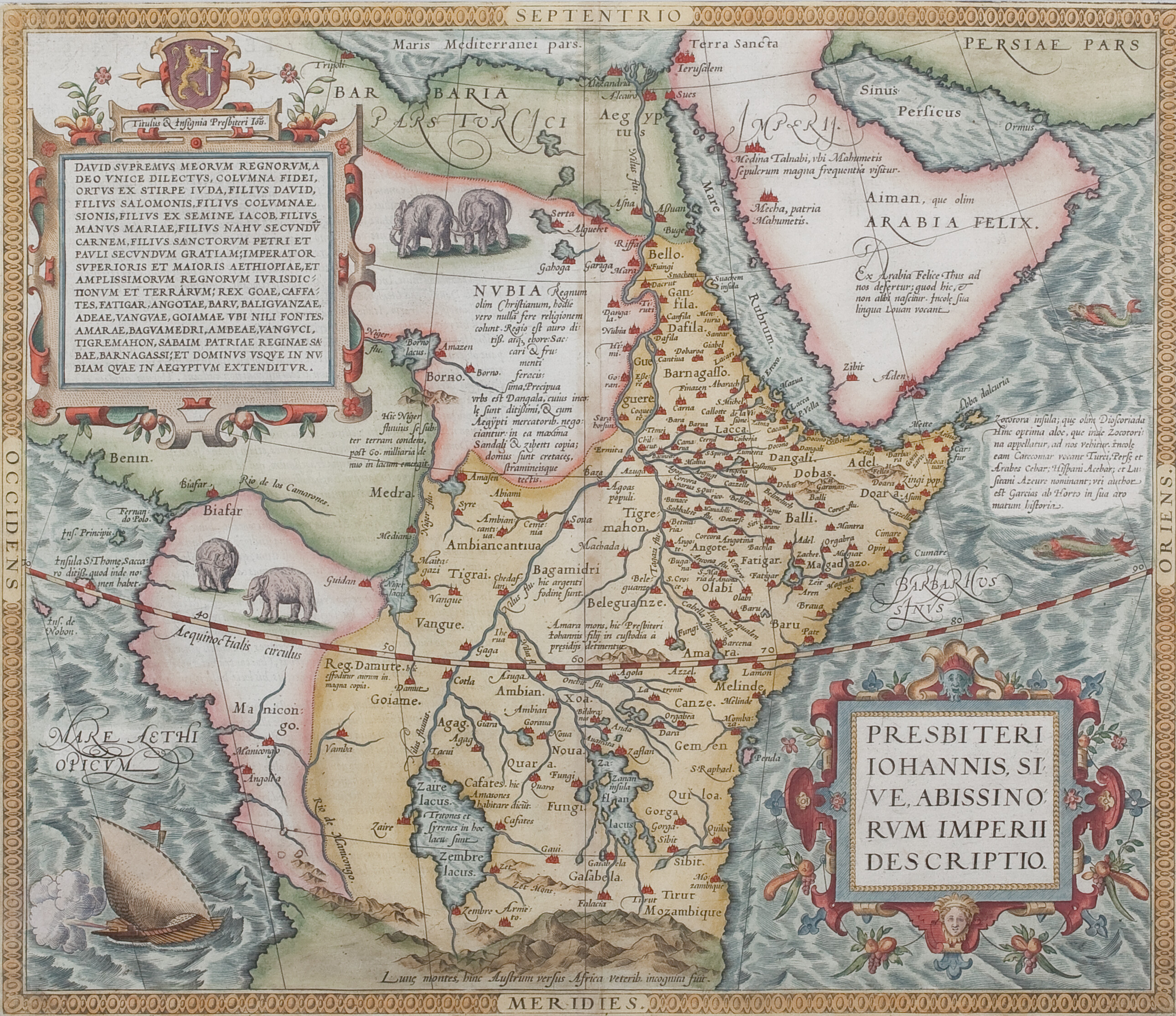
Abraham Ortelius, 1574
‘Presbiteri Iohannis, sive Abissinorum Imperii Descripto’, from Theatrum Orbis Terrarum
Scroll or use +/− to zoom · drag to pan · double-click to zoom in
This map is taken from the first atlas of the world ever published, and indicates the extent of European knowledge of Ethiopia and surrounding areas in the 1570s. While much of it is highly speculative, it does show some familiar names, including Bahrnagasso (the territory of the Bahr Negash, corresponding to much of present-day Eritrea), Tigray, Bagemder, Gojjam and Amhara. It is particularly interesting in showing both of the main branches of the Nile as flowing from large lakes, with Lake Zaire/Zembre as the source of the White Nile, now known as Lake Victoria, and Lake Zafran as the source of the Blue Nile, corresponding to Lake Tana, even though both are placed well south of the Equator. The territory of the Ethiopian empire is vastly exaggerated, extending up to the frontier with Egypt, as well as to the Red Sea, which had been lost in the 1550s, and to much of central Africa. Ortelius presumably gained much of his information from the Catholic missionaries in Ethiopia at that time.
Download original scan (TIFF, 16.5 MB)