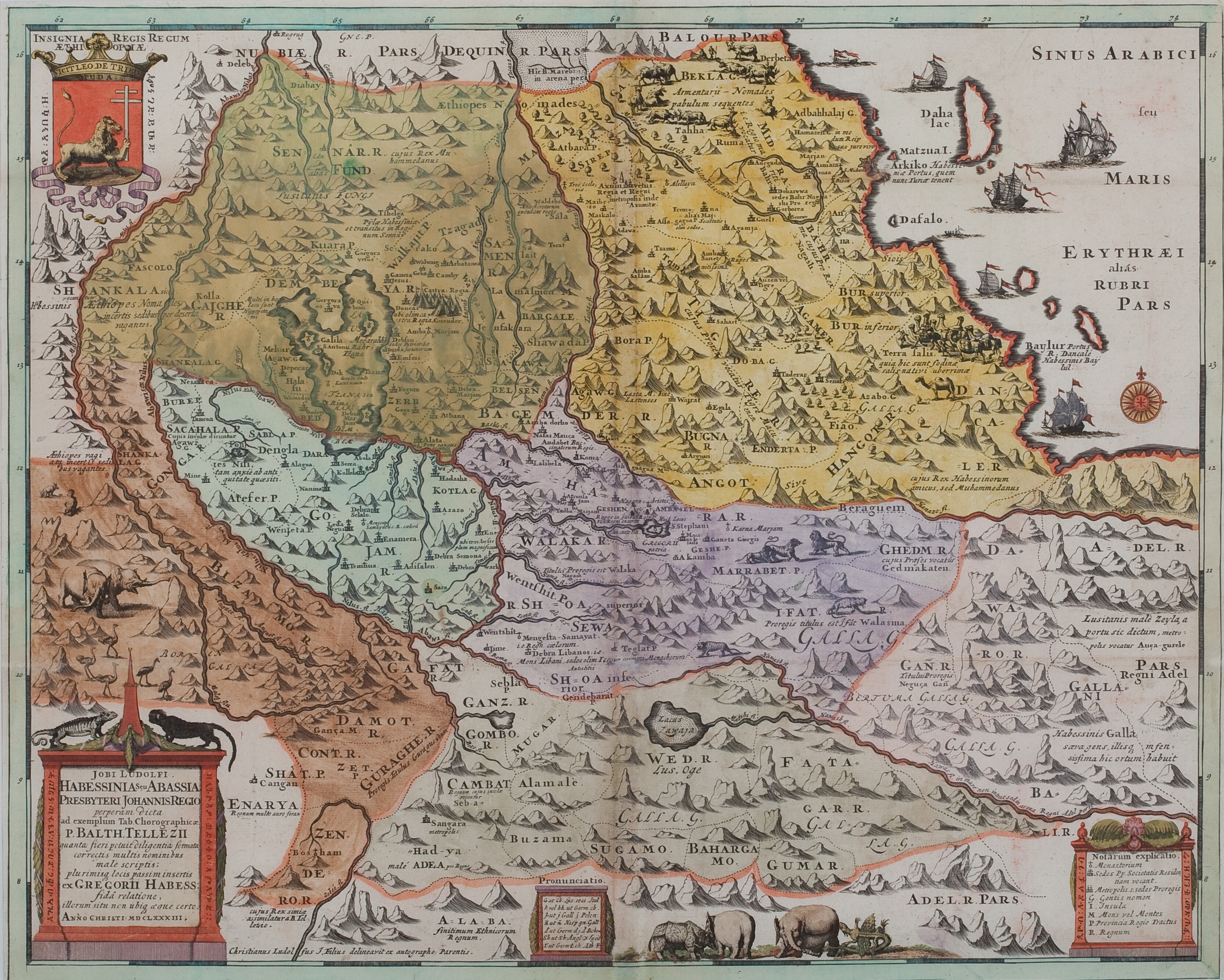
Hiob Ludolf, 1683
‘Jobi Ludolfi Habessinia seu Abassia Presbyteri Johannis Regio perperam dicta’
Scroll or use +/− to zoom · drag to pan · double-click to zoom in
This is the map that transformed the European understanding of Ethiopia, and derived from the collaboration between Ludolf, widely recognised as the father of Ethiopian studies, and his Ethiopian colleague Abba Gorgorios. For the first time, it shows the correct course of the Abbay or Blue Nile, rising from Lake Tana and curling around Gojjam. It is also the first map to identify the Oromo (here, as was invariably the case until the 1970s, described as Galla) as well as other southern peoples including Kambata and Hadiya. Note also the depiction of camels being loaded with salt bars (or amole) in the Afar depression, for transport to the highlands.
Download original scan (TIFF, 25.5 MB)