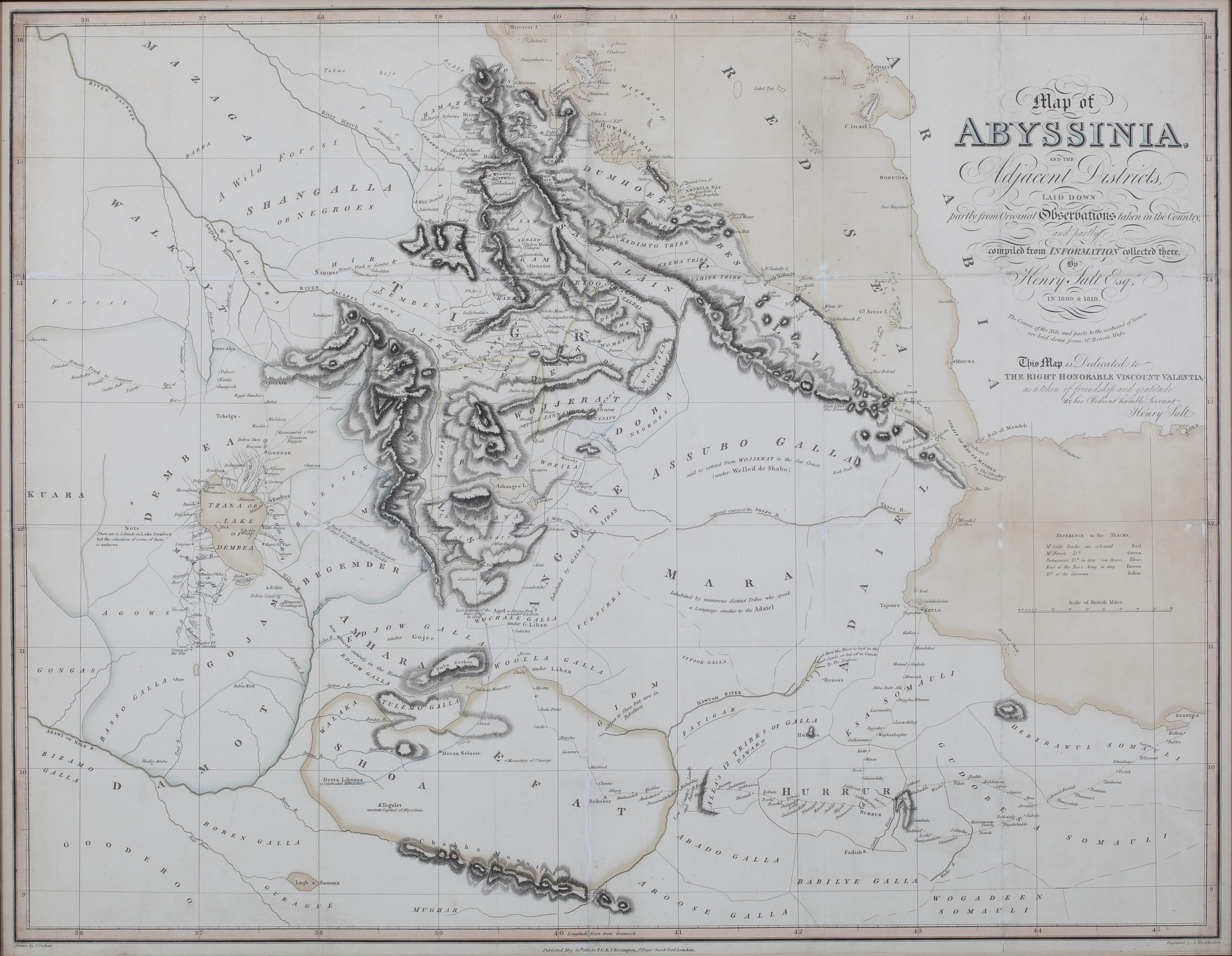
Henry Salt, 1814
‘Map of Abyssinia and the Adjacent Districts’, from A Voyage to Abyssinia
Scroll or use +/− to zoom · drag to pan · double-click to zoom in
This map greatly extends the European understanding of Ethiopia in the early 19th century. Salt visited the area on behalf of the UK government, in response to its enhanced strategic importance revealed by Napoleon’s Egyptian campaign. However, it is noteworthy chiefly for providing far greater detail on the peoples of what is now southern Ethiopia and the Somali territories than had previously been available. In particular, it distinguishes between different groups of Galla/Oromo, and is the first map even to indicate the existence of the Somali, together with the territories of several of the most noteworthy Somali clans, including the Issa, Habr Awal, Ogaden and Gadabursi. It also marks the stopping places for camel caravans on the trails from Zeila and Berbera to Harar and the highlands at Ankober. This is all the more remarkable in that Salt never visited these areas himself, but simply travelled from Massawa into Tigray and Welo. No European visited Harar until Burton in the 1850s. This is most plausibly explained by his encounter in Yemen with two Harari merchants, who must presumably have supplied a vast amount of information. The result is a map that views the region through African rather than European eyes. A fuller analysis, Christopher Clapham, "Henry Salt and the Mapping of Ethiopia", is to be published in Northeast African Studies.
Download original scan (TIFF, 47.3 MB)