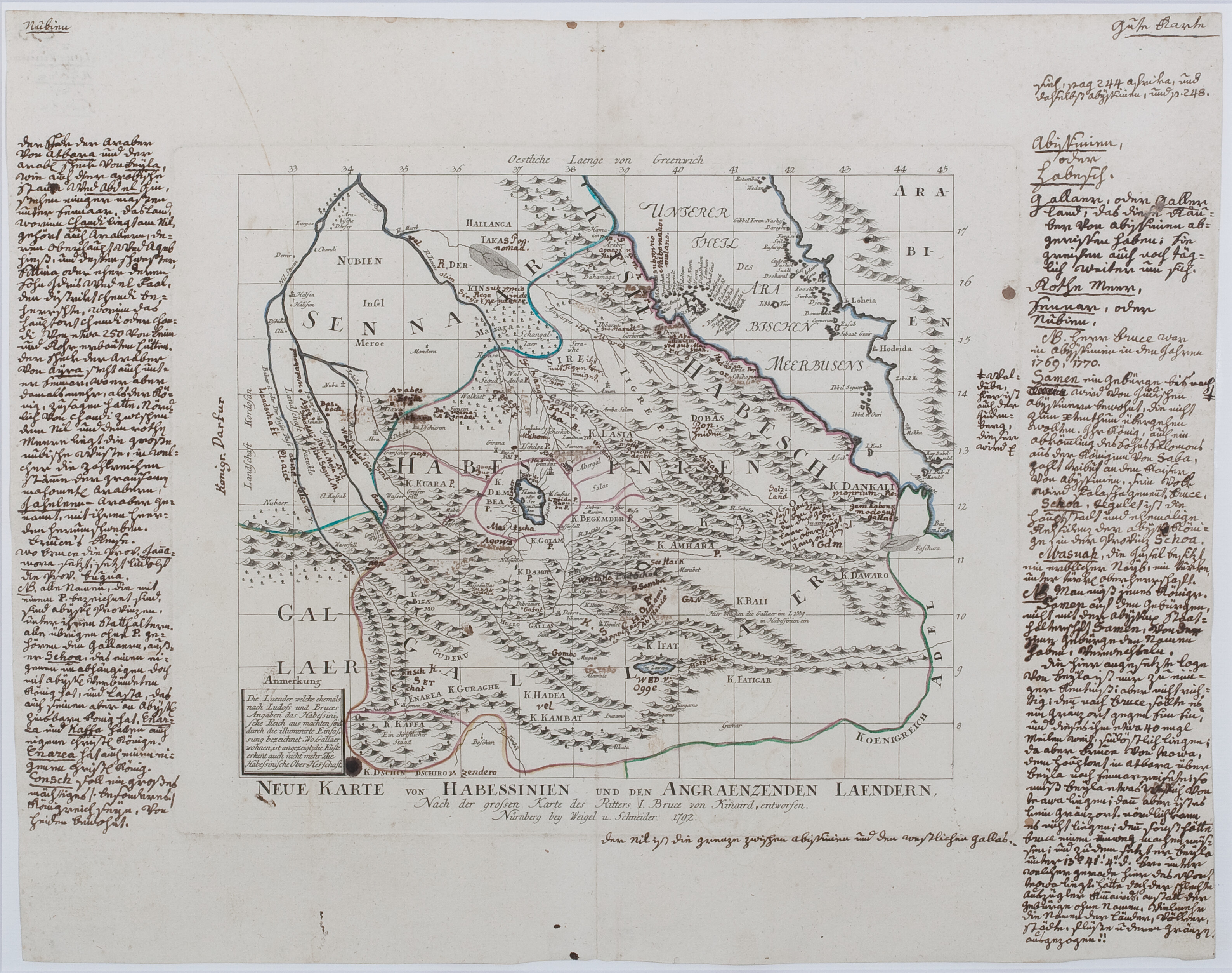
Weigel und Schneider, 1792
‘Neue Karte von Habessinien und der Angraenzenden Laendern’, Nuremberg
Scroll or use +/− to zoom · drag to pan · double-click to zoom in
The printed map is essentially a German language edition of Bruce’s map in his Travels to Discover the Source of the Nile, published in 1790, but covered with a massive number of original manuscript German comments that can only have been written by a German traveller in Ethiopia in the 1790s or early 1800s. Wolbert Smidt has deciphered and translated these, and a fuller description and analysis is published in Wolbert Smidt and Christopher Clapham, "An annotated late eighteenth century map of Ethiopia", in Wolbert G.C. Smidt & Sophia Thubauville, eds., Cultural Research in Northeastern Africa: German Histories and Stories, Frankfurt am Main: Frobenius Institute, 2015, which however is unable to identify who this traveller was.
Download original scan (TIFF, 22.8 MB)